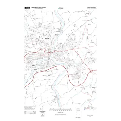
2013 Map of Easton
USGS Topo · Published 2013About this map
The Delaware River and Lehigh River converge at the heart of this regional hub, defining the complex geography of eastern Pennsylvania and western New Jersey. The 2013 landscape shows the dense urban development of South Easton and West Easton, alongside residential neighborhoods like Odenweldertown, Wilson, and Glendon. North of the city center, the terrain rises toward Chestnut Hill and Paxinosa, where local landmarks like Saint Anthonys Nose overlook the river valley. The map documents a significant transportation corridor, where major routes like Us 22 and I-78 cross the water between Alpha, New Jersey, and the Pennsylvania shore. Smaller settlements such as Raubsville and Carpentersville sit further south along the Delaware, while Braden Airpark and Hartung Airport serve as localized aviation markers in the suburban and rural fringes.
Find a feature on this map
54 named features on this map. Tap any name to fly to it.
Don’t see what you’re looking for? This feature index may not catch every label — zoom into the map to look around manually.
Map Details
Editions of this 2013 Easton Map
This is the sole edition of this map. No revisions or reprints were ever made.
Other maps of this area

1890 · Easton
USGS Topo · 1:62,500

1891 · Easton
USGS Topo · 1:62,500

1891 · Delaware Water Gap
USGS Topo · 1:62,500

1893 · Delaware Water Gap
USGS Topo · 1:62,500

1894 · Allentown
USGS Topo · 1:62,500

1914 · Wind Gap
USGS Topo · 1:62,500

1916 · Wind Gap
USGS Topo · 1:62,500

1932 · Easton
USGS Topo · 1:62,500

1936 · Delaware Water Gap
USGS Topo · 1:48,000

1939 · Allentown
USGS Topo · 1:62,500