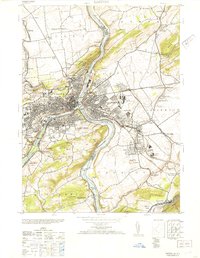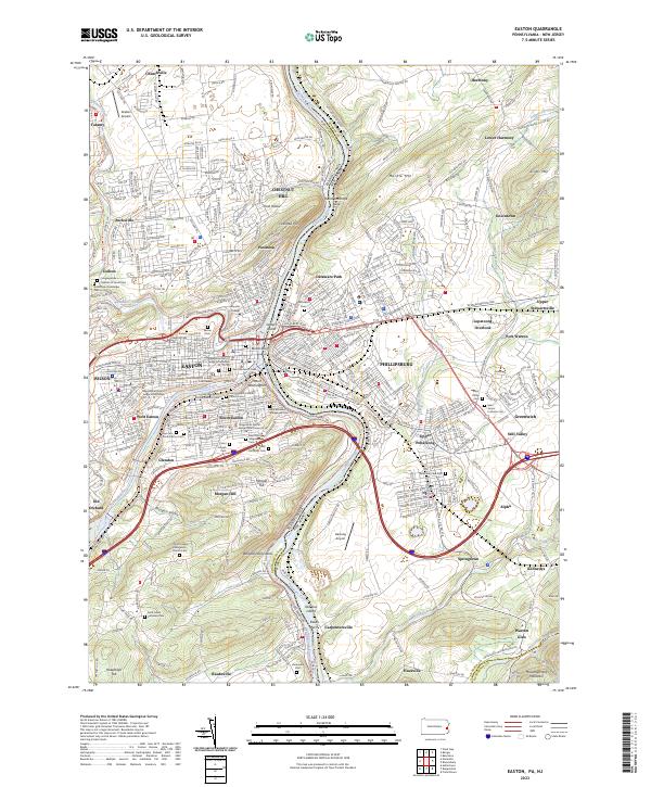
2023 Map of Easton
USGS Topo · Published 2023About this map
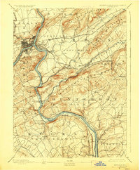
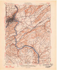
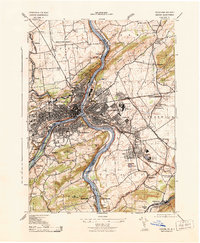
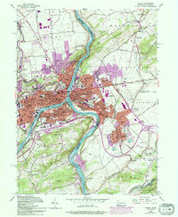
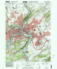
Easton stands as a prominent hub at the confluence of the Lehigh River and Delaware River, where industrial transit corridors and educational history converge. This survey details the urban layout of the city and its surrounding boroughs, including Wilson, West Easton, and South Easton. The campus of Lafayette College occupies the heights above the downtown district, while the Northampton County Courthouse serves as the local civic anchor. Across the river in New Jersey, Phillipsburg and its residential expansions like Delaware Park reveal a landscape shaped by transportation, with the Pennsylvania RR and Lehigh Valley RR carving routes through the river valley. The map is particularly valuable for its density of burial grounds, such as Saint Josephs Catholic Church Cem and Bhai Abraham Synagogue Cem 1, which reflect the diverse immigrant communities that built the region’s industrial foundation. Landmarks like St Anthony's Nose and Chestnut Hill overlook a valley transitioning from the urban core to the rural reaches of Raubsville and Morgan Valley.
Find a feature on this map
112 named features on this map. Tap any name to fly to it.
Don’t see what you’re looking for? This feature index may not catch every label — zoom into the map to look around manually.
Map Details
Editions of this 2023 Easton Map
This is the sole edition of this map. No revisions or reprints were ever made.
Historical Maps of Alpha Through Time
8 maps found