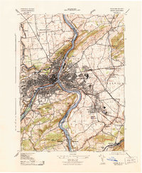
1943 Map of Easton
USGS Topo · Published 1943About this map
The Delaware River serves as the focal point for this 1943 survey, acting as both a natural border and a corridor for heavy industry during the war years. Easton and Phillipsburg dominate the central landscape, showing a dense network of transportation infrastructure where the Lehigh Canal and Pennsylvania Canal parallel the riverbanks. The industrial character of the era is evident in the presence of the Vulcanite Cement Co and prominent landmarks like the C K Williams Co Stack and the Ing Rand Stack.
Find a feature on this map
75 named features on this map. Tap any name to fly to it.
Don’t see what you’re looking for? This feature index may not catch every label — zoom into the map to look around manually.
Map Details
Editions of this 1943 Easton Map
This is the sole edition of this map. No revisions or reprints were ever made.
Other maps of this area

1890 · Easton
USGS Topo · 1:62,500

1891 · Easton
USGS Topo · 1:62,500

1891 · Delaware Water Gap
USGS Topo · 1:62,500

1893 · Delaware Water Gap
USGS Topo · 1:62,500

1894 · Allentown
USGS Topo · 1:62,500

1914 · Wind Gap
USGS Topo · 1:62,500

1916 · Wind Gap
USGS Topo · 1:62,500

1932 · Easton
USGS Topo · 1:62,500

1936 · Delaware Water Gap
USGS Topo · 1:48,000

1939 · Allentown
USGS Topo · 1:62,500