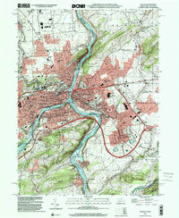
1999 Map of Easton
USGS Topo · Published 2001About this map
The confluence of the Lehigh River and the Delaware River serves as the industrial and geographic anchor for Easton, Pennsylvania, and Phillipsburg, New Jersey, at the close of the 20th century. This survey details a landscape defined by heavy infrastructure and early 19th-century legacies, most notably the path of the Morris Canal as it winds through Lopatcong. The map meticulously identifies the dense urban cores of Wilson, West Easton, and South Easton, while tracing the expansion into surrounding townships such as Palmer and Greenwich.
Find a feature on this map
86 named features on this map. Tap any name to fly to it.
Don’t see what you’re looking for? This feature index may not catch every label — zoom into the map to look around manually.
Map Details
Editions of this 1999 Easton Map
This is the sole edition of this map. No revisions or reprints were ever made.
Other maps of this area

1890 · Easton
USGS Topo · 1:62,500

1891 · Easton
USGS Topo · 1:62,500

1891 · Delaware Water Gap
USGS Topo · 1:62,500

1893 · Delaware Water Gap
USGS Topo · 1:62,500

1894 · Allentown
USGS Topo · 1:62,500

1914 · Wind Gap
USGS Topo · 1:62,500

1916 · Wind Gap
USGS Topo · 1:62,500

1932 · Easton
USGS Topo · 1:62,500

1936 · Delaware Water Gap
USGS Topo · 1:48,000

1939 · Allentown
USGS Topo · 1:62,500