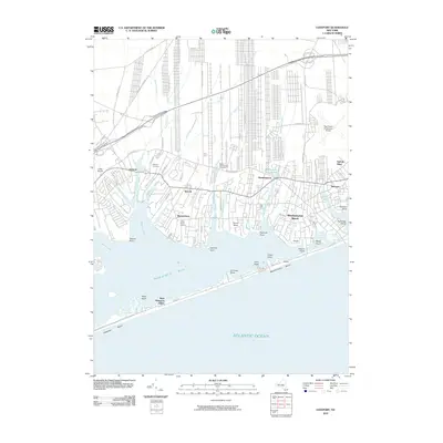
2010 Map of Eastport
USGS Topo · Published 2010About this map
Seatuck Cove and Moriches Bay define the southern geography of this coastal Long Island region, where numerous inlets and necks create a complex shoreline. The transition from the residential clusters of Eastport and Speonk to the barrier beach of West Hampton Dunes illustrates the area’s distinct environmental zones. Local history and genealogy interest is anchored by the Eastport Cemetery and the Tuthill Burial Ground, while the Bide-A-Wee Animal Cemetery represents a unique community landmark. Transportation and land use patterns are visible through the proximity of Lufker Airport and the larger The Francis S Gabreski Airport. The map traces the winding paths of the Speonk River and Seatuck Creek as they feed into the bay, alongside a network of older thoroughfares like Toppings Path and Moriches-Riverhead Rd.
Find a feature on this map
64 named features on this map. Tap any name to fly to it.
Don’t see what you’re looking for? This feature index may not catch every label — zoom into the map to look around manually.
Map Details
Editions of this 2010 Eastport Map
This is the sole edition of this map. No revisions or reprints were ever made.
Other maps of this area

1903 · Riverhead
USGS Topo · 1:62,500

1904 · Riverhead
USGS Topo · 1:62,500

1904 · Moriches
USGS Topo · 1:62,500

1943 · Riverhead
USGS Topo · 1:62,500

1947 · Mattituck
USGS Topo · 1:24,000

1947 · Riverhead
USGS Topo · 1:24,000

1947 · Quogue
USGS Topo · 1:24,000

1947 · Eastport
USGS Topo · 1:24,000

1949 · New York
USGS Topo · 1:250,000

1954 · New York
USGS Topo · 1:250,000