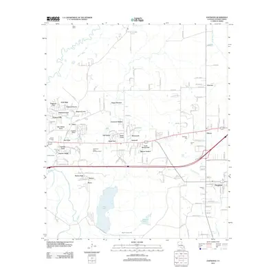
2012 Map of Eastwood
USGS Topo · Published 2012About this map
Red Chute Bayou and Bodcau Bayou snake through this corner of Bossier Parish, defining a landscape where suburban expansion meets the region's industrial and natural heritage. The map documents the rapid development of residential communities like Dogwood Park, Crestwood Heights, and Mimosa Gardens, which contrast with the sprawling Sligo Oil and Gas Field occupying the southern portion of the sheet. This industrial footprint sits adjacent to the wide waters of Flag Lake and Harmon Lake, illustrating the close proximity of resource extraction and local recreation areas.
Find a feature on this map
143 named features on this map. Tap any name to fly to it.
Don’t see what you’re looking for? This feature index may not catch every label — zoom into the map to look around manually.
Map Details
Editions of this 2012 Eastwood Map
This is the sole edition of this map. No revisions or reprints were ever made.
Other maps of this area

1932 · Bossier SE
USGS Topo · 1:31,680

1932 · Bossier NE
USGS Topo · 1:31,680

1932 · Bossier SW
USGS Topo · 1:31,680

1932 · Bossier NW
USGS Topo · 1:31,680

1938 · Arnsberg
USGS Topo · 1:31,680

1941 · Forbing
USGS Topo · 1:31,680

1947 · Ringgold
USGS Topo · 1:62,500

1947 · Minden
USGS Topo · 1:62,500

1948 · Bossier City
USGS Topo · 1:62,500

1948 · Caspiana
USGS Topo · 1:62,500