
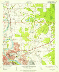
1941 Map of Forbing
USGS Topo · Published 1941About this map
The meandering Red River defines this landscape south of Shreveport, where the 1941 topography illustrates the complex relationship between the waterway and the surrounding parishes. Dramatic river dynamics are evident in features like Shreves Cut-Off 1838, Sunflower Point, and several oxbow formations such as Sunny Point Lake and Muddy Lake. This river-driven economy is supported by a robust rail network, including the Kansas City Southern and the Texas and Pacific Railway which cut through the lowlands.
Find a feature on this map
64 named features on this map. Tap any name to fly to it.
Don’t see what you’re looking for? This feature index may not catch every label — zoom into the map to look around manually.
Map Details
Editions of this 1941 Forbing Map
This is the sole edition of this map. No revisions or reprints were ever made.
Other maps of this area

1932 · Bossier SE
USGS Topo · 1:31,680

1932 · Bossier SW
USGS Topo · 1:31,680

1932 · Shreveport SE
USGS Topo · 1:31,680

1938 · Arnsberg
USGS Topo · 1:31,680

1945 · Greenwood
USGS Topo · 1:62,500

1948 · Mooringsport
USGS Topo · 1:62,500

1948 · Bossier City
USGS Topo · 1:62,500

1948 · Caspiana
USGS Topo · 1:62,500

1955 · Shreveport
USGS Topo · 1:250,000
1955 · Bossier City
USGS Topo · 1:24,000