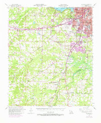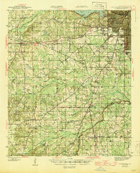
1945 Map of Greenwood
USGS Topo · Published 1945About this map
Shreveport dominates the northeast corner of this mid-1940s landscape, where urban expansion meets the rural bayous of Caddo Parish. The city's edge is defined by institutional landmarks such as the State Fair Grounds, the Sanitarium, and Fair Park High Sch. Beyond the city, the region transitions into a dense network of small farming communities and educational hubs like Flournoy, Reisor, and Keithville, each supported by local institutions such as Home Union Sch and Center Point Sch.
Find a feature on this map
75 named features on this map. Tap any name to fly to it.
Don’t see what you’re looking for? This feature index may not catch every label — zoom into the map to look around manually.
Map Details
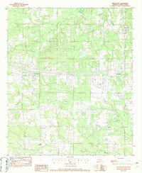
Editions of this 1945 Greenwood Map
This is the sole edition of this map. No revisions or reprints were ever made.
Historical Maps of Shreveport Through Time
8 maps found