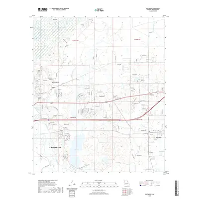
2020 Map of Eastwood
USGS Topo · Published 2020About this map
Bossier City and the expanding residential corridors of Eastwood define this landscape east of the Red River valley. The area is marked by a complex network of bayous and lowlands, where the Red Chute Bayou and Connell Bayou meander through a mix of established neighborhoods and undeveloped terrain near Flag Lake. These waterways have long shaped the settlement patterns of Bossier Parish, dictating the placement of older crossroads like Fillmore and Adner.
Find a feature on this map
140 named features on this map. Tap any name to fly to it.
Don’t see what you’re looking for? This feature index may not catch every label — zoom into the map to look around manually.
Map Details
Editions of this 2020 Eastwood Map
This is the sole edition of this map. No revisions or reprints were ever made.
Other maps of this area

1932 · Bossier SE
USGS Topo · 1:31,680

1932 · Bossier NE
USGS Topo · 1:31,680

1932 · Bossier SW
USGS Topo · 1:31,680

1932 · Bossier NW
USGS Topo · 1:31,680

1938 · Arnsberg
USGS Topo · 1:31,680

1941 · Forbing
USGS Topo · 1:31,680

1947 · Ringgold
USGS Topo · 1:62,500

1947 · Minden
USGS Topo · 1:62,500

1948 · Bossier City
USGS Topo · 1:62,500

1948 · Caspiana
USGS Topo · 1:62,500