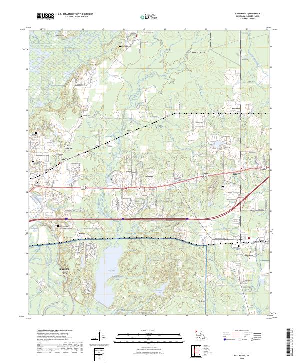
2024 Map of Eastwood
USGS Topo · Published 2024About this map
Bossier City expands into the pine-topped hills of northwestern Louisiana, where modern suburban development meets the established rural hamlets of Eastwood and Fillmore. The landscape is defined by the winding course of Bodcau Creek and Red Chute Bayou, which drain the lowlands between Barksdale AFB and the northern ridges. A dense network of local cemeteries, including Pease Chapel Cem and Fellowship Cem, highlights the area's deep-rooted family history. The southern portion of the map is dominated by the military reservation surrounding Flag Lake, while small communities like Haughton and Princeton maintain their distinct identities along the highway corridors. The presence of numerous small bayous like Connell Bayou and Foxskin Bayou illustrates the complex drainage patterns typical of this Red River tributary region.
Find a feature on this map
179 named features on this map. Tap any name to fly to it.
Don’t see what you’re looking for? This feature index may not catch every label — zoom into the map to look around manually.
Map Details
Editions of this 2024 Eastwood Map
This is the sole edition of this map. No revisions or reprints were ever made.
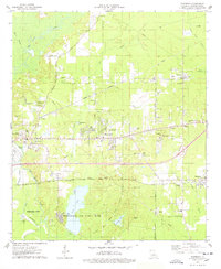
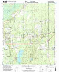
Historical Maps of Adner Through Time
3 maps found