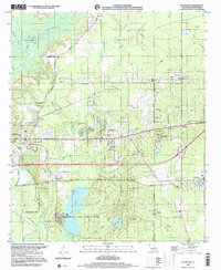
1999 Map of Eastwood
USGS Topo · Published 2000About this map
Barksdale Air Force Base occupies a significant portion of this Bossier Parish landscape, where military infrastructure meets the winding waterways of the Red River valley. The terrain is defined by complex bayou systems, including Red Chute Bayou and Pigeon Roost Bayou, which weave through a network of small communities and rural church sites. This area north of Bossier City shows a distinct pattern of residential growth around Eastwood and Haughton, contrasted by industrial features like an oil refinery and various gravel pits. Local heritage is visible in the numerous small congregations such as Hopewell Ch and Zion Hill Ch, while the Eastwood Fairways Country Club signals the 20th-century suburban development of the region. The map also traces the extent of the Louisiana Downs grounds, marking the intersection of sporting, military, and rural life at the end of the century.
Find a feature on this map
55 named features on this map. Tap any name to fly to it.
Don’t see what you’re looking for? This feature index may not catch every label — zoom into the map to look around manually.
Map Details
Editions of this 1999 Eastwood Map
This is the sole edition of this map. No revisions or reprints were ever made.
Other maps of this area

1932 · Bossier SE
USGS Topo · 1:31,680

1932 · Bossier NE
USGS Topo · 1:31,680

1932 · Bossier SW
USGS Topo · 1:31,680

1932 · Bossier NW
USGS Topo · 1:31,680

1938 · Arnsberg
USGS Topo · 1:31,680

1941 · Forbing
USGS Topo · 1:31,680

1947 · Ringgold
USGS Topo · 1:62,500

1947 · Minden
USGS Topo · 1:62,500

1948 · Bossier City
USGS Topo · 1:62,500

1948 · Caspiana
USGS Topo · 1:62,500