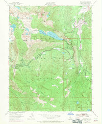
1955 Map of Echo Lake
USGS Topo · Published 1971About this map
Meyers stands as a focal point of this high-altitude landscape, where the Pioneer Trail and U S Highway 50 meet near the Upper Truckee River. The map details a transition in alpine recreation during the mid-20th century, showing established institutions like the Meyers Sch and Celio Ranch alongside numerous group camps such as Camp Sacramento and the Berkeley Muni Camp. Just to the west, the Desolation Wilderness protects a dense concentration of glacial basins, including Lake of the Woods and Tamarack Lake. Significant infrastructure for travelers and residents is evident at Echo Summit, which features an Aerial Tramway and a maintenance station. The geography is defined by steep granite peaks like Ralston Peak and the dramatic drop of Horsetail Falls into the canyon of the South Fork American River.
Find a feature on this map
79 named features on this map. Tap any name to fly to it.
Don’t see what you’re looking for? This feature index may not catch every label — zoom into the map to look around manually.
Map Details
Editions of this 1955 Echo Lake Map
4 editions found
Other maps of this area

1889 · Pyramid Peak
USGS Topo · 1:125,000

1889 · Markleeville
USGS Topo · 1:125,000

1891 · Markleeville
USGS Topo · 1:125,000

1891 · Pyramid Peak
USGS Topo · 1:125,000

1893 · Markleeville
USGS Topo · 1:125,000

1895 · Pyramid Peak
USGS Topo · 1:125,000

1896 · Pyramid Peak
USGS Topo · 1:125,000

1947 · Sacramento
USGS Topo · 1:250,000

1948 · Walker Lake
USGS Topo · 1:250,000

1948 · Sacramento
USGS Topo · 1:250,000