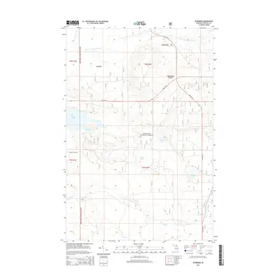
2014 Map of Eckerman
USGS Topo · Published 2014About this map
Eckerman and Seewhy serve as the primary coordinates for this portion of the Hiawatha National Forest in Michigan's Upper Peninsula. The landscape is defined by its complex hydrology, dominated by the East Br Tahquamenon River to the north and the Hendrie River system to the south. Numerous small basins and wetlands are named throughout the quadrangle, including Riley Lake, Hulbert Lake, and the more secluded Pardy Pond.
Find a feature on this map
22 named features on this map. Tap any name to fly to it.
Don’t see what you’re looking for? This feature index may not catch every label — zoom into the map to look around manually.
Map Details
Editions of this 2014 Eckerman Map
This is the sole edition of this map. No revisions or reprints were ever made.
Other maps of this area

1931 · Epoufette NE
USGS Topo · 1:31,680

1931 · Epoufette NW
USGS Topo · 1:31,680

1941 · Strongs
USGS Topo · 1:63,360

1951 · Strongs
USGS Topo · 1:24,000

1951 · McNearney Lake
USGS Topo · 1:24,000

1951 · Piatt Lake
USGS Topo · 1:24,000

1951 · Big Beaver Creek
USGS Topo · 1:24,000

1951 · Hulbert
USGS Topo · 1:24,000

1951 · Eckerman
USGS Topo · 1:24,000

1951 · Strongs
USGS Topo · 1:62,500