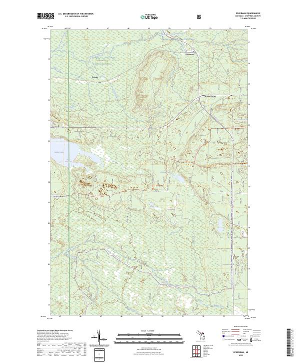
2023 Map of Eckerman
USGS Topo · Published 2023About this map
Eckerman and Seewhy anchor this portion of the Eastern Upper Peninsula, situated within the sprawling bounds of the Hiawatha National Forest. The landscape is defined by its complex hydrology, dominated in the north by the East Branch Tahquamenon Wild and Scenic River and its numerous tributaries like Creek Number Fourteen and Riley Creek. To the south, the drainage shifts toward the Hendrie River and Naugle Creek. This territory is characterized by extensive wetlands and isolated water bodies, including Hulbert Lake and the smaller Little Mud Lake. Modern transit through the forest is marked by a network of specialized paths such as the Raco-hulbert Sorva Route Trl and the Trout Lake-Hulbert Snowmo Trl, which follow the corridors of an earlier era's logging and rail routes.
Find a feature on this map
27 named features on this map. Tap any name to fly to it.
Don’t see what you’re looking for? This feature index may not catch every label — zoom into the map to look around manually.
Map Details
Editions of this 2023 Eckerman Map
This is the sole edition of this map. No revisions or reprints were ever made.
Other maps of this area

1931 · Epoufette NE
USGS Topo · 1:31,680

1931 · Epoufette NW
USGS Topo · 1:31,680

1941 · Strongs
USGS Topo · 1:63,360

1951 · Strongs
USGS Topo · 1:24,000

1951 · McNearney Lake
USGS Topo · 1:24,000

1951 · Piatt Lake
USGS Topo · 1:24,000

1951 · Big Beaver Creek
USGS Topo · 1:24,000

1951 · Hulbert
USGS Topo · 1:24,000

1951 · Eckerman
USGS Topo · 1:24,000

1951 · Strongs
USGS Topo · 1:62,500