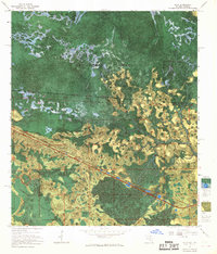
1967 Map of Eddy
USGS Topo · Published 1968About this map
Eddy sits along the Georgia-Florida state line, serving as a rare point of human habitation in a landscape dominated by the vast wetlands of the Okefenokee National Wildlife Refuge. This 1967 experimental orthophotomap uses a photomosaic base to distinguish between dense tree cover and the numerous Lake Holes and swamp prairies that define the Okefenokee Swamp. The Southern railroad cuts a straight path through the mire, passing by a Radio Lookout Tower that stands as a vital sentinel over the timber-rich landscape.
Find a feature on this map
22 named features on this map. Tap any name to fly to it.
Don’t see what you’re looking for? This feature index may not catch every label — zoom into the map to look around manually.
Map Details
Editions of this 1967 Eddy Map
This is the sole edition of this map. No revisions or reprints were ever made.
Other maps of this area

1917 · Macclenny
USGS Topo · 1:62,500

1918 · Moniac
USGS Topo · 1:62,500

1918 · Macclenny
USGS Topo · 1:62,500

1942 · Moniac
USGS Topo · 1:62,500

1954 · Valdosta
USGS Topo · 1:250,000

1956 · Eddy
USGS Topo · 1:24,000

1956 · Sargent
USGS Topo · 1:24,000

1958 · Valdosta
USGS Topo · 1:250,000

1959 · Valdosta
USGS Topo · 1:250,000

1965 · Chesser Island
USGS Topo · 1:24,000