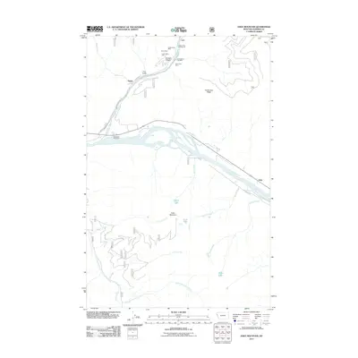
2011 Map of Eddy Mountain
USGS Topo · Published 2011About this map
The Thompson River and Clark Fork converge in this Sanders County landscape, creating a focal point for early 21st-century infrastructure and historical industry. Near the settlement of Snider, the Thompson River Spur indicates the area's rail-reliant economic history, while Thompson River Rd and River Rd W provide the primary transit corridors through the river valleys. The northern hills are marked by a cluster of mineral claims, including the Copper King Mine, Raven Mine, and Silver King Mine, centered around the steep topography of Buckeye Canyon and Liver Gulch.
Find a feature on this map
28 named features on this map. Tap any name to fly to it.
Don’t see what you’re looking for? This feature index may not catch every label — zoom into the map to look around manually.
Map Details
Editions of this 2011 Eddy Mountain Map
This is the sole edition of this map. No revisions or reprints were ever made.
Other maps of this area

1918 · St Regis
USGS Topo · 1:125,000

1919 · St. Regis
USGS Topo · 1:125,000

1937 · Thompson Falls
USGS Topo · 1:125,000

1937 · Thompson Falls
USGS Topo · 1:62,500

1956 · St Regis
USGS Topo · 1:62,500

1956 · Wallace
USGS Topo · 1:250,000

1957 · Thompson Falls
USGS Topo · 1:62,500

1957 · Haugan
USGS Topo · 1:62,500

1960 · Wallace
USGS Topo · 1:250,000

1964 · Calico Creek
USGS Topo · 1:24,000