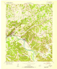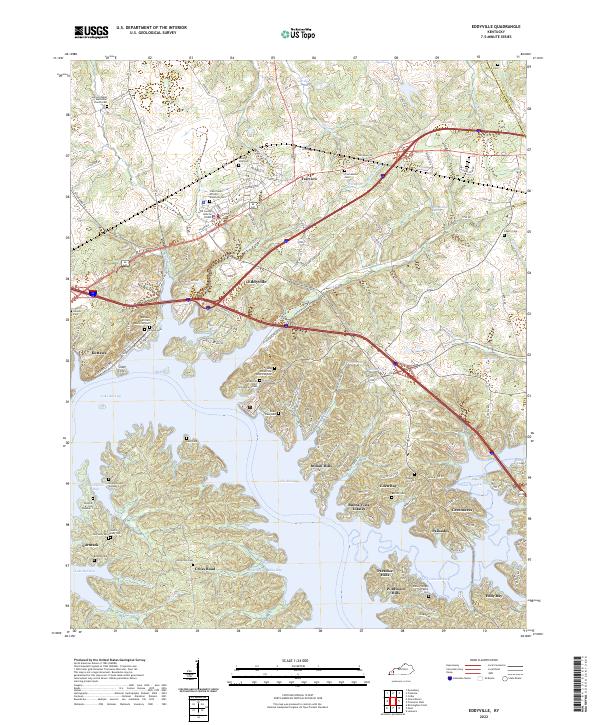
2022 Map of Eddyville
USGS Topo · Published 2022About this map
Lake Barkley dominates the landscape of Lyon County, surrounding the central community of Eddyville and defining the modern character of Kuttawa. The sprawling waters of the reservoir create a complex shoreline marked by Davenport Bay, Clay Bay, and the prominent Silver Cliffs. This survey is particularly significant for genealogists, as it meticulously identifies numerous family and community burial sites, including several historic African American cemeteries such as the Kuttawa African American Cem and Crab Creek African American Cem.
Find a feature on this map
136 named features on this map. Tap any name to fly to it.
Don’t see what you’re looking for? This feature index may not catch every label — zoom into the map to look around manually.
Map Details
Editions of this 2022 Eddyville Map
This is the sole edition of this map. No revisions or reprints were ever made.
Historical Maps of Eden Bay Through Time
7 maps found