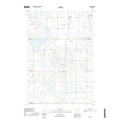
2017 Map of Eden
USGS Topo · Published 2017About this map
Eden and Roslyn anchor this section of the Coteau des Prairies highlands, a distinctive plateau region characterized by a high density of glacial prairie potholes and wetlands. The landscape is a complex mosaic of water bodies, ranging from the expansive Hazelden Lake and Opitz Lake to smaller features like Redman Slough. This distribution of water significantly influenced the rural road grid, forcing routes like CO Hwy 16 and various section-line roads to navigate between marshy depressions. For those tracing family histories in Day and Marshall Counties, the map identifies key religious and community landmarks, including Saint Michael's Cem, the German Lutheran Cem, and the Saron Free Lutheran Cem, each serving as a marker of the area's pioneer heritage and the ethnic denominations that settled these prairie townships.
Find a feature on this map
28 named features on this map. Tap any name to fly to it.
Don’t see what you’re looking for? This feature index may not catch every label — zoom into the map to look around manually.
Map Details
Editions of this 2017 Eden Map
This is the sole edition of this map. No revisions or reprints were ever made.
Other maps of this area
1953 · Milbank
USGS Topo · 1:250,000
1958 · Milbank
USGS Topo · 1:250,000
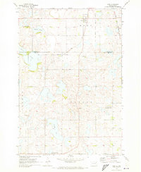
1970 · Eden
USGS Topo · 1:24,000
1970 · Britton 4 NE
USGS Topo · 1:24,000
1970 · South Red Iron Lake
USGS Topo · 1:24,000
1970 · Lake City
USGS Topo · 1:24,000
1970 · Piyas Lake
USGS Topo · 1:24,000
1970 · Britton 4 SE
USGS Topo · 1:24,000
1970 · Roslyn
USGS Topo · 1:24,000
1970 · Enemy Swim Lake West
USGS Topo · 1:24,000