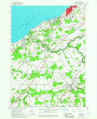
1965 Map of Eden
USGS Topo · Published 1967About this map
The shoreline of Lake Erie defines the western edge of this mid-1960s Erie County landscape, where the transition from lakeside vacation communities to inland agricultural centers is evident. Near the coast, the planned street grids of Highland-on-the-Lake and Wanakah reflect a growing suburban footprint, while further inland, the village of Eden maintains its traditional layout at the junction of the Erie-Lackawanna railroad. Local landmarks such as the Queen of Apostles Seminary and St Josephs Wayside Shrine mark the cultural landscape alongside numerous parochial and public institutions like Our Lady of Perpetual Help Sch and Central High Sch.
Find a feature on this map
61 named features on this map. Tap any name to fly to it.
Don’t see what you’re looking for? This feature index may not catch every label — zoom into the map to look around manually.
Map Details
Editions of this 1965 Eden Map
This is the sole edition of this map. No revisions or reprints were ever made.
Other maps of this area

1894 · Buffalo
USGS Topo · 1:62,500

1899 · Silver Creek
USGS Topo · 1:62,500

1901 · Buffalo
USGS Topo · 1:62,500

1905 · Eden
USGS Topo · 1:62,500

1907 · Eden
USGS Topo · 1:62,500

1944 · Eden
USGS Topo · 1:62,500

1944 · North Collins
USGS Topo · 1:31,680

1944 · Hamburg
USGS Topo · 1:31,680
1944 · Angola
USGS Topo · 1:31,680

1944 · Farnham
USGS Topo · 1:31,680