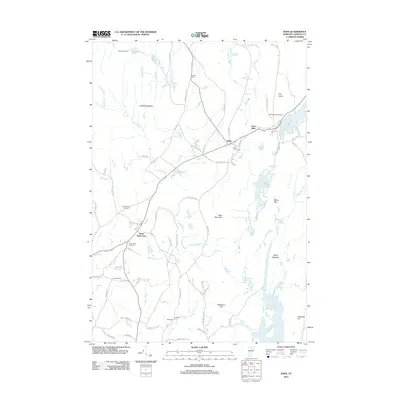
2012 Map of Eden
USGS Topo · Published 2012About this map
The Gihon River and its numerous tributaries shape this portion of Lamoille County, where the settlement of Eden sits at a central crossroads. This 2012 survey illustrates a landscape deeply integrated with its water resources, from the northern Ritterbush Pond to the expansive Green River Reservoir in the south. Local heritage is preserved through a high density of small burial grounds, such as Dodge Cem and Eden Corner Cem, which are scattered throughout the hills. The transition from industrial or extraction history to recreation is evident in place names like Upper Diggings and the presence of the Lakeview Campground near Lake Eden. Notable topographic features like Bean Mountain and The Knob overlook a network of rural roads, including Knowles Flat Rd and Baker Rd, while the village of North Hyde Park serves as a southern anchor for the community.
Find a feature on this map
96 named features on this map. Tap any name to fly to it.
Don’t see what you’re looking for? This feature index may not catch every label — zoom into the map to look around manually.
Map Details
Editions of this 2012 Eden Map
This is the sole edition of this map. No revisions or reprints were ever made.
Other maps of this area

1919 · Montgomery
USGS Topo · 1:62,500

1920 · Montgomery
USGS Topo · 1:62,500

1920 · Irasburg
USGS Topo · 1:62,500

1923 · Irasburg
USGS Topo · 1:48,000

1925 · Irasburg
USGS Topo · 1:62,500

1925 · Jay Peak
USGS Topo · 1:62,500

1927 · Hyde Park
USGS Topo · 1:48,000

1928 · Hardwick
USGS Topo · 1:62,500

1930 · Hyde Park
USGS Topo · 1:62,500

1934 · Hardwick
USGS Topo · 1:48,000