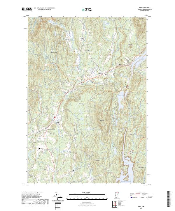
2024 Map of Eden
USGS Topo · Published 2024About this map
Eden Mills and the village of Eden serve as the primary hubs in this part of Lamoille County, where the Gihon River and its various tributaries carve through the Green Mountains. The landscape is defined by its water features, ranging from the recreational expanse of Lake Eden to the sequestered waters of Ritterbush Pond and the Green River Reservoir. A series of small, family-named burial grounds like Dodge Cem and Holbrook Cem are scattered throughout the hills, providing a clear genealogical record of the region's early settlers and long-standing farming communities.
Find a feature on this map
84 named features on this map. Tap any name to fly to it.
Don’t see what you’re looking for? This feature index may not catch every label — zoom into the map to look around manually.
Map Details
Editions of this 2024 Eden Map
This is the sole edition of this map. No revisions or reprints were ever made.
Other maps of this area

1919 · Montgomery
USGS Topo · 1:62,500

1920 · Montgomery
USGS Topo · 1:62,500

1920 · Irasburg
USGS Topo · 1:62,500

1923 · Irasburg
USGS Topo · 1:48,000

1925 · Irasburg
USGS Topo · 1:62,500

1925 · Jay Peak
USGS Topo · 1:62,500

1927 · Hyde Park
USGS Topo · 1:48,000

1928 · Hardwick
USGS Topo · 1:62,500

1930 · Hyde Park
USGS Topo · 1:62,500

1934 · Hardwick
USGS Topo · 1:48,000