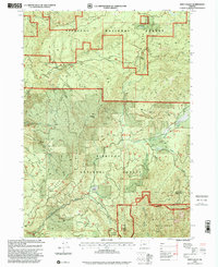
1998 Map of Eden Valley
USGS Topo · Published 2001About this map
Eden Ridge dominates this section of the Siskiyou National Forest along the border of Coos and Curry counties. In the late 1990s, the area's landscape is defined by the steep drainages of the South Fork Coquille River and its numerous tributaries, including Barker Creek and Foggy Creek. This survey details a timber-and-recreation economy, evidenced by several remote outposts like Coal Creek Camp and a network of Forest Service roads connecting high points such as Table Rock and Gobblers Knob. The presence of the Wild Rogue Wilderness in the southern portion of the sheet highlights the preservation of primitive areas alongside active industrial sites like the Quarry. Local history researchers can trace old campsites such as Pioneer Campground and Eden Valley Campground, which serve as key landmarks in this heavily forested terrain.
Find a feature on this map
27 named features on this map. Tap any name to fly to it.
Don’t see what you’re looking for? This feature index may not catch every label — zoom into the map to look around manually.
Map Details
Editions of this 1998 Eden Valley Map
This is the sole edition of this map. No revisions or reprints were ever made.
Other maps of this area

1899 · Port Orford
USGS Topo · 1:125,000

1903 · Port Orford
USGS Topo · 1:125,000

1954 · Coos Bay
USGS Topo · 1:250,000

1954 · Bone Mountain
USGS Topo · 1:62,500

1954 · Marial
USGS Topo · 1:62,500

1954 · Agness
USGS Topo · 1:62,500

1954 · Powers
USGS Topo · 1:62,500

1955 · Medford
USGS Topo · 1:250,000

1957 · Medford
USGS Topo · 1:250,000

1958 · Medford
USGS Topo · 1:250,000