
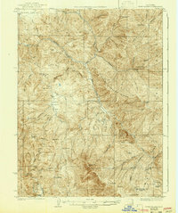
1929 Map of Eden Valley
USGS Topo · Published 1929About this map
The Middle Fork Eel River carves a deep path through this interior Mendocino County landscape, where the rugged topography of the California National Forest meets early ranching and seasonal outposts. Surveyed in the mid-1920s, the map reveals a remote network of camps and family-named landmarks like Crocker Place and Camp Grant that served as anchors in the wilderness. The high peaks of Mt Sanhedrin and Bald Mtn overlook a complex drainage system defined by Thatcher Creek and Elk Creek, illustrating the territory's transition from the broad floor of Round Valley in the north to the confined reaches of Eden Valley. This era shows the land before modern development, still largely traversed by routes such as the Mendenhall Trail rather than improved highways.
Find a feature on this map
68 named features on this map. Tap any name to fly to it.
Don’t see what you’re looking for? This feature index may not catch every label — zoom into the map to look around manually.
Map Details
Editions of this 1929 Eden Valley Map
2 editions found
Other maps of this area

1920 · Covelo
USGS Topo · 1:62,500

1922 · Willits
USGS Topo · 1:62,500

1922 · Hullville
USGS Topo · 1:62,500

1926 · Covelo
USGS Topo · 1:62,500

1942 · Willits
USGS Topo · 1:62,500

1943 · Pomo
USGS Topo · 1:62,500

1944 · Willits
USGS Topo · 1:62,500

1951 · Lake Pillsbury
USGS Topo · 1:62,500

1951 · Laytonville
USGS Topo · 1:62,500

1952 · Hull Mountain
USGS Topo · 1:62,500