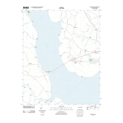
2010 Map of Edenhouse
USGS Topo · Published 2010About this map
The Chowan River dominates this coastal landscape, serving as a historic conduit for commerce and travel along its wide banks. The western shore is dotted with numerous small landings and wharves, such as Mount Gould Landing, Steele Landing, and Hermitage Wharf, which point to a local economy historically tied to the water. At Edenhouse Point, the crossing is anchored by the settlement of Edenhouse, where Governor Eden House road reflects the region's colonial heritage.
Find a feature on this map
54 named features on this map. Tap any name to fly to it.
Don’t see what you’re looking for? This feature index may not catch every label — zoom into the map to look around manually.
Map Details
Editions of this 2010 Edenhouse Map
This is the sole edition of this map. No revisions or reprints were ever made.
Other maps of this area

1904 · Edenton
USGS Topo · 1:62,500

1942 · Edenton
USGS Topo · 1:62,500

1943 · Plymouth
USGS Topo · 1:125,000

1943 · Edenton
USGS Topo · 1:62,500

1953 · Norfolk
USGS Topo · 1:250,000

1953 · Rocky Mount
USGS Topo · 1:250,000

1954 · Rocky Mount
USGS Topo · 1:250,000

1954 · Roper North
USGS Topo · 1:24,000

1954 · Westover
USGS Topo · 1:24,000
1979 · Woodard
USGS Topo · 1:24,000