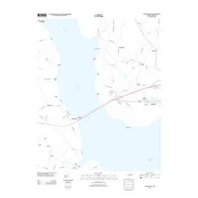
2013 Map of Edenhouse
USGS Topo · Published 2013About this map
The Chowan River dominates this coastal landscape, serving as a historic corridor where numerous landings and fisheries once supported the regional economy. Near Edenhouse Point, the river transitions toward the Atlantic Ocean, framed by the expansive waters that define life in Chowan County. The survey illustrates a network of maritime-oriented settlements, including Blackrock and Macedonia, alongside specialized sites like the Edenton National Fish Hatchery.
Find a feature on this map
78 named features on this map. Tap any name to fly to it.
Don’t see what you’re looking for? This feature index may not catch every label — zoom into the map to look around manually.
Map Details
Editions of this 2013 Edenhouse Map
This is the sole edition of this map. No revisions or reprints were ever made.
Other maps of this area

1904 · Edenton
USGS Topo · 1:62,500

1942 · Edenton
USGS Topo · 1:62,500

1943 · Plymouth
USGS Topo · 1:125,000

1943 · Edenton
USGS Topo · 1:62,500

1953 · Norfolk
USGS Topo · 1:250,000

1953 · Rocky Mount
USGS Topo · 1:250,000

1954 · Rocky Mount
USGS Topo · 1:250,000

1954 · Roper North
USGS Topo · 1:24,000

1954 · Westover
USGS Topo · 1:24,000
1979 · Woodard
USGS Topo · 1:24,000