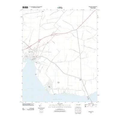
2010 Map of Edenton
USGS Topo · Published 2010About this map
Edenton sits at the head of the Albemarle Sound, its street grid centered on the Courthouse Green and bounded by the waters of Pembroke Creek. This 2010 survey illustrates the town's coastal expansion, showing residential developments like Cape Colony and the nearby Edenton Municipal Airport. Genealogists will find significant value in the detailed plotting of local burial grounds, including the Beaver Hill Cemetery, Vine Oak Cemetery, and Johnston Cemetery, which are preserved alongside family-named landmarks like Hayes Farm Rd.
Find a feature on this map
43 named features on this map. Tap any name to fly to it.
Don’t see what you’re looking for? This feature index may not catch every label — zoom into the map to look around manually.
Map Details
Editions of this 2010 Edenton Map
This is the sole edition of this map. No revisions or reprints were ever made.
Other maps of this area

1904 · Edenton
USGS Topo · 1:62,500

1906 · Hertford
USGS Topo · 1:62,500

1940 · Hertford
USGS Topo · 1:62,500

1942 · Edenton
USGS Topo · 1:62,500

1943 · Columbia
USGS Topo · 1:125,000

1943 · Plymouth
USGS Topo · 1:125,000

1943 · Edenton
USGS Topo · 1:62,500

1953 · Norfolk
USGS Topo · 1:250,000

1953 · Rocky Mount
USGS Topo · 1:250,000

1954 · Rocky Mount
USGS Topo · 1:250,000