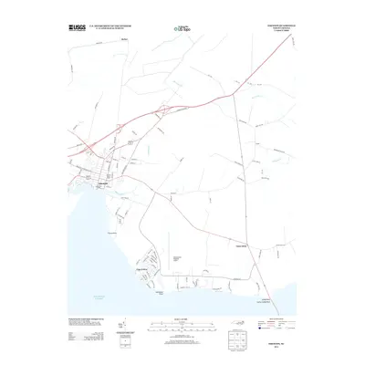
2013 Map of Edenton
USGS Topo · Published 2013About this map
Edenton sits at the confluence of history and the Atlantic Ocean shoreline in this coastal North Carolina survey. The town center is anchored by the Courthouse Green, a primary landmark for local historians and genealogists tracing the early development of Chowan County. The landscape is defined by the winding paths of Burnt Mill Creek and Pembroke Creek, which separate the established town from outlying settlements like Yeopim and Saint Johns. Further south, the suburban expansion of Cape Colony reaches toward Horniblow Point, while the Northeastern Regional Airport marks the shift toward modern regional infrastructure. This era captures the delicate balance between the area's maritime heritage and its continued growth, visible in the network of rural roads such as Old Hertford Road and Shannon House Road that connect these waterside communities.
Find a feature on this map
90 named features on this map. Tap any name to fly to it.
Don’t see what you’re looking for? This feature index may not catch every label — zoom into the map to look around manually.
Map Details
Editions of this 2013 Edenton Map
This is the sole edition of this map. No revisions or reprints were ever made.
Other maps of this area

1904 · Edenton
USGS Topo · 1:62,500

1906 · Hertford
USGS Topo · 1:62,500

1940 · Hertford
USGS Topo · 1:62,500

1942 · Edenton
USGS Topo · 1:62,500

1943 · Columbia
USGS Topo · 1:125,000

1943 · Plymouth
USGS Topo · 1:125,000

1943 · Edenton
USGS Topo · 1:62,500

1953 · Norfolk
USGS Topo · 1:250,000

1953 · Rocky Mount
USGS Topo · 1:250,000

1954 · Rocky Mount
USGS Topo · 1:250,000