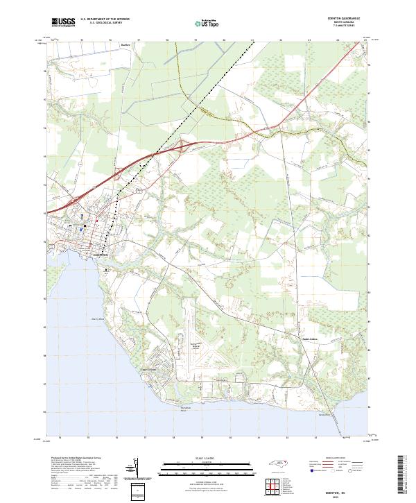
2022 Map of Edenton
USGS Topo · Published 2022About this map
Edenton serves as the historic center of this coastal landscape, situated where Pembroke Creek meets the bay. The town's grid is anchored by the Chowan County Courthouse and a cluster of local heritage sites, including Beaver Hill Cem and Vine Oak Cem. To the north and east, the terrain transitions into a patchwork of woodland and wetlands drained by Burnt Mill Cr and Middleton Cr, reflecting the low-lying geography of the Albemarle region.
Find a feature on this map
90 named features on this map. Tap any name to fly to it.
Don’t see what you’re looking for? This feature index may not catch every label — zoom into the map to look around manually.
Map Details
Editions of this 2022 Edenton Map
This is the sole edition of this map. No revisions or reprints were ever made.
Other maps of this area

1904 · Edenton
USGS Topo · 1:62,500

1906 · Hertford
USGS Topo · 1:62,500

1940 · Hertford
USGS Topo · 1:62,500

1942 · Edenton
USGS Topo · 1:62,500

1943 · Columbia
USGS Topo · 1:125,000

1943 · Plymouth
USGS Topo · 1:125,000

1943 · Edenton
USGS Topo · 1:62,500

1953 · Norfolk
USGS Topo · 1:250,000

1953 · Rocky Mount
USGS Topo · 1:250,000

1954 · Rocky Mount
USGS Topo · 1:250,000