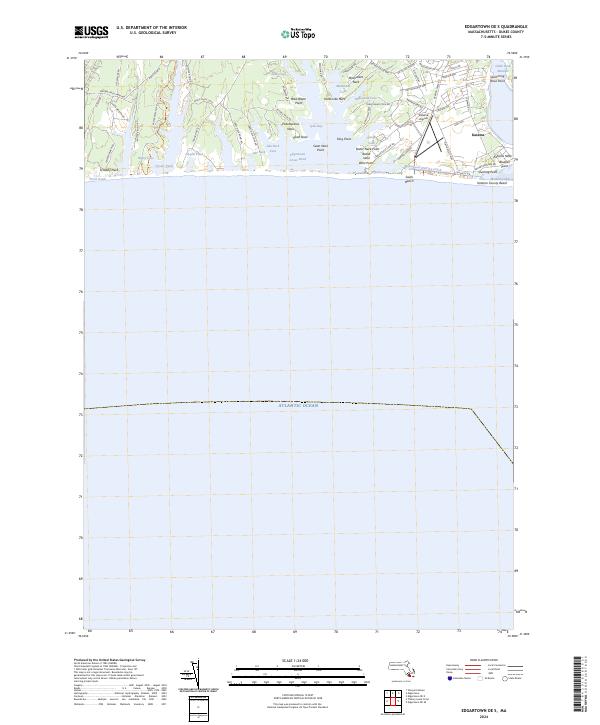
2024 Map of Edgartown OE S
USGS Topo · Published 2024About this map
Edgartown Great Pond dominates this coastal landscape on Martha's Vineyard, where the Atlantic shoreline meets a complex network of glacial ponds and finger-like necks. The eastern portion of the map is defined by the settlement of Katama and the Katama Airpark, illustrating the area's development as a seasonal and aviation hub. A series of distinctive landforms, including Scrubby Neck, Kanomika Neck, and Mashacket Neck, reach into the brackish waters of the Great Pond and Oyster Pond.
Find a feature on this map
71 named features on this map. Tap any name to fly to it.
Don’t see what you’re looking for? This feature index may not catch every label — zoom into the map to look around manually.
Map Details
Editions of this 2024 Edgartown OE S Map
This is the sole edition of this map. No revisions or reprints were ever made.
Other maps of this area

1887 · Marthas Vineyard
USGS Topo · 1:62,500

1889 · Marthas Vineyard
USGS Topo · 1:62,500

1894 · Marthas Vineyard
USGS Topo · 1:62,500

1942 · Marthas Vineyard
USGS Topo · 1:125,000

1942 · Nantucket
USGS Topo · 1:125,000

1944 · Tisbury Great Pond
USGS Topo · 1:31,680

1944 · Vineyard Haven
USGS Topo · 1:31,680
1944 · Edgartown
USGS Topo · 1:31,680

1947 · Providence
USGS Topo · 1:250,000

1948 · Providence
USGS Topo · 1:250,000