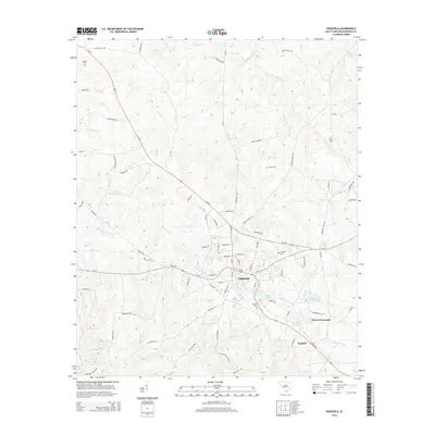
2014 Map of Edgefield
USGS Topo · Published 2014About this map
Edgefield serves as the focal point of this South Carolina landscape, where a radial network of roads including Us-25 and SC-23 converge at the town center. The settlement pattern reflects deep-rooted local history, evidenced by numerous family-named burial sites such as Blocker Cem, Bland Cem, and Frazier Cem. To the east, the smaller settlements of Huets Crossroads and Parkhill sit near the headwaters of Tabler Cr, while the surrounding terrain is defined by a dense system of tributaries. Significant water bodies like Slade Lake and Odell Memorial Lake are situated just outside the main town limits. This 2014 survey documents the modern street grid of the county seat, featuring historic corridors like Jeter St and Addison St, alongside rural reaches defined by the winding courses of Turkey Cr and Log Cr.
Find a feature on this map
79 named features on this map. Tap any name to fly to it.
Don’t see what you’re looking for? This feature index may not catch every label — zoom into the map to look around manually.
Map Details
Editions of this 2014 Edgefield Map
This is the sole edition of this map. No revisions or reprints were ever made.
Other maps of this area

1892 · Mc Cormick
USGS Topo · 1:125,000

1912 · Mc Cormick
USGS Topo · 1:125,000

1920 · Clarks Hill
USGS Topo · 1:48,000

1921 · Clarks Hill
USGS Topo · 1:62,500

1923 · Warrenville
USGS Topo · 1:48,000

1928 · Warrenville
USGS Topo · 1:62,500

1941 · Clarks Hill
USGS Topo · 1:62,500

1942 · Clarks Hill
USGS Topo · 1:62,500

1943 · Warrenville
USGS Topo · 1:62,500

1953 · Athens
USGS Topo · 1:250,000