Loading...
Loading map...2023 Map of Edgerton
USGS Topo · Published 2023About this map
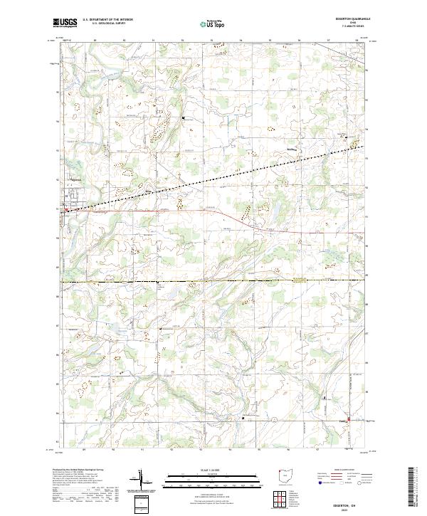
Edgerton serves as the primary hub in this corner of Northwest Ohio, where the village street grid meets the winding Saint Joseph River. The landscape is a well-defined patchwork of township roads and section lines spanning the border of Williams Co and Defiance Co. Small agricultural hamlets and crossroads like Mina, Melbern, and Farmer anchor the surrounding rural territory, each tied to the drainage basins of Fish Creek and Lost Creek.
Find a feature on this map
83 named features on this map. Tap any name to fly to it.
Don’t see what you’re looking for? This feature index may not catch every label — zoom into the map to look around manually.
Map Details
Date Portrayed2023
Date Published2023
PublisherU.S. Geological Survey
Map TypeTopographic
Scale1:24000
Physical Dimensions24 x 29 inches
Editions of this 2023 Edgerton Map
This is the sole edition of this map. No revisions or reprints were ever made.
Historical Maps of Valley Springs Addition Through Time
Featured Locations
- Farmer Township, OH
- Center Township, OH
- Farmer, Farmer Township
- Edgerton, St. Joseph Township
- Melbern, Center Township
Source Details
SourceU.S. Geological Survey
CopyrightPublic Domain