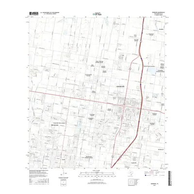
2016 Map of Edinburg
USGS Topo · Published 2016About this map
Edinburg and northern McAllen are the central hubs of this South Texas landscape, defined by an intricate network of residential colonias and vital agricultural infrastructure. The presence of the University of Texas-Pan American anchors the urban core, while the surrounding area is partitioned into numerous distinct communities such as Sauceda Colonia, Lopezville, and César Chávez. The region's dependence on irrigation is evidenced by the Edinburg N Main Canal and the Santa Cruz Canal, which cut through the grid of roads and settlements. Local history is preserved at the Old Edinburg Cemetery and Hillcrest Memorial Park, while the Norman & White Airport serves the north. This survey illustrates the dense development patterns and community naming conventions characteristic of the Rio Grande Valley in the early 21st century.
Find a feature on this map
272 named features on this map. Tap any name to fly to it.
Don’t see what you’re looking for? This feature index may not catch every label — zoom into the map to look around manually.
Map Details
Editions of this 2016 Edinburg Map
This is the sole edition of this map. No revisions or reprints were ever made.
Other maps of this area

1914 · San Juan
USGS Topo · 1:48,000

1916 · San Juan
USGS Topo · 1:62,500

1940 · Monte Christo
USGS Topo · 1:62,500

1949 · Mc Allen
USGS Topo · 1:250,000

1954 · McAllen
USGS Topo · 1:250,000

1957 · Mc Allen
USGS Topo · 1:250,000

1962 · McAllen
USGS Topo · 1:250,000

1963 · Monte Christo
USGS Topo · 1:24,000
1963 · Hargill
USGS Topo · 1:24,000

1963 · Edinburg
USGS Topo · 1:24,000