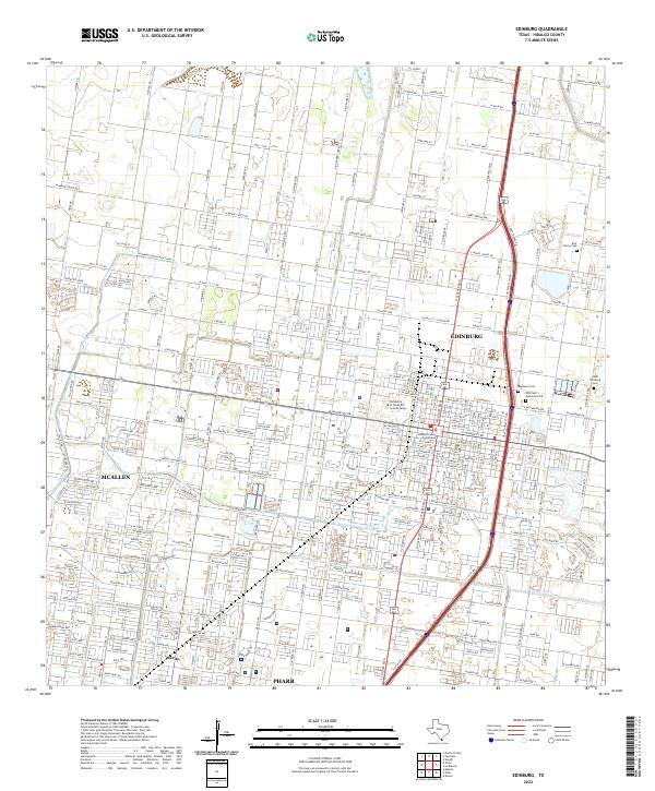
2022 Map of Edinburg
USGS Topo · Published 2022About this map
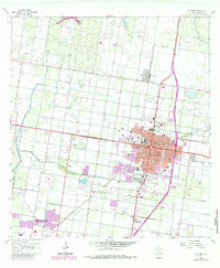
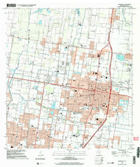
Edinburg serves as the focal point of this South Texas landscape, where the dense grid of the city meets the vital irrigation systems of the Rio Grande Valley. The presence of the Hidalgo County Courthouse and the sprawling campus of the University of Texas Rio Grande Valley highlights the city's role as a regional administrative and educational hub. The agricultural heritage of the area is visible in the network of waterways that sustain the citrus and row crops, including the Edinburg North Main Canal and the Edinburg East Main Canal. Neighborhoods like Lull and Merito sit alongside these canals, illustrating how settlement patterns followed the path of water. For those researching local history or genealogy, several burial grounds are documented, ranging from the Old Edinburg Cem to the family-specific Rios Family Cem and the larger Hillcrest Memorial Park.
Find a feature on this map
46 named features on this map. Tap any name to fly to it.
Don’t see what you’re looking for? This feature index may not catch every label — zoom into the map to look around manually.
Map Details
Editions of this 2022 Edinburg Map
This is the sole edition of this map. No revisions or reprints were ever made.
Historical Maps of Ranchette Estates Colonia Through Time
3 maps found