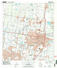
2002 Map of Edinburg
USGS Topo · Published 2003About this map
The University of Texas Pan American serves as a central anchor in this survey of Edinburg, Texas, where the transition from agricultural roots to modern suburban development is clearly visible. The map details an extensive network of educational facilities ranging from the Rio Grande Bible Institute to numerous local schools like Zavala Sch and Escandon Sch. Industrial and utility infrastructure such as the Filtration Plant, the Hidalgo Co Water District No 1, and the Edinburg Gas Field Road highlight the region's managed resources. In the north, the small settlement of Lull and the expansive Lake Edinburg contrast with the dense urban grid of northern McAllen to the south. Notable for genealogists are the Old Edinburg Cemetery and Hillcrest Memorial Park, alongside numerous parks like Bicentennial Park and Fountain Park that define the city's public spaces.
Find a feature on this map
68 named features on this map. Tap any name to fly to it.
Don’t see what you’re looking for? This feature index may not catch every label — zoom into the map to look around manually.
Map Details
Editions of this 2002 Edinburg Map
This is the sole edition of this map. No revisions or reprints were ever made.
Other maps of this area

1914 · San Juan
USGS Topo · 1:48,000

1916 · San Juan
USGS Topo · 1:62,500

1940 · Monte Christo
USGS Topo · 1:62,500

1949 · Mc Allen
USGS Topo · 1:250,000

1954 · McAllen
USGS Topo · 1:250,000

1957 · Mc Allen
USGS Topo · 1:250,000

1962 · McAllen
USGS Topo · 1:250,000

1963 · Monte Christo
USGS Topo · 1:24,000
1963 · Hargill
USGS Topo · 1:24,000

1963 · Edinburg
USGS Topo · 1:24,000
Featured Places
- McAllen, TX
- Edinburg, TX
- Pharr, TX
- Citrus City Lake Number 1 Colonia, TX
- Evangeline Gardens Colonia, Edinburg