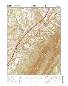
2016 Map of Edinburg
USGS Topo · Published 2016About this map
Edinburg and Woodstock anchor this portion of the Shenandoah Valley, where the North Fork Shenandoah River carves the distinctive Seven Bends through the landscape. The geography is defined by the contrast between the fertile valley floor and the rising ridges of the George Washington National Forest to the east. This 2016 survey documents the enduring layout of the region, from the tight clusters of Edinburg and Mount Jackson to the rural crossings at Bowmans Crossing and Hawkinstown.
Find a feature on this map
114 named features on this map. Tap any name to fly to it.
Don’t see what you’re looking for? This feature index may not catch every label — zoom into the map to look around manually.
Map Details
Editions of this 2016 Edinburg Map
This is the sole edition of this map. No revisions or reprints were ever made.
Other maps of this area

1892 · Woodstock
USGS Topo · 1:125,000

1893 · Luray
USGS Topo · 1:125,000

1905 · Luray
USGS Topo · 1:125,000

1923 · Edinburg
USGS Topo · 1:62,500

1929 · Stony Man
USGS Topo · 1:48,000

1933 · Stony Man
USGS Topo · 1:62,500

1942 · Mt Jackson
USGS Topo · 1:62,500

1946 · Mt Jackson
USGS Topo · 1:62,500

1947 · Mt Jackson
USGS Topo · 1:62,500

1947 · Strasburg
USGS Topo · 1:62,500