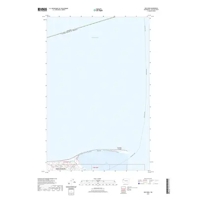
2020 Map of Ediz Hook
USGS Topo · Published 2020About this map
Ediz Hook defines the northern edge of the harbor in this 2020 topographic study of the Olympic Peninsula coastline. This distinctive sand spit protects the deep waters of Port Angeles Harbor and serves as the site for the Port Angeles Coast Guard Air Station at its eastern tip. Within the city of Port Angeles, the residential and commercial grid is detailed along streets such as W 8th St and Marine Dr. North of the shoreline, the vast Salish Sea stretches toward the maritime boundary where Canada and the United States of America meet. The map also delineates the route of the Port Angeles Ferry, a critical transport link crossing the open water. A small body of water known as The Lagoon is visible near the base of the hook, illustrating the specific coastal geography of this Pacific Northwest port.
Find a feature on this map
21 named features on this map. Tap any name to fly to it.
Don’t see what you’re looking for? This feature index may not catch every label — zoom into the map to look around manually.
Map Details
Editions of this 2020 Ediz Hook Map
This is the sole edition of this map. No revisions or reprints were ever made.
Other maps of this area

1918 · Port Angeles
USGS Topo · 1:62,500

1919 · Port Crescent
USGS Topo · 1:62,500

1941 · Port Angeles
USGS Topo · 1:62,500

1950 · Elwha
USGS Topo · 1:24,000

1950 · Ediz Hook
USGS Topo · 1:24,000
1950 · Angeles Point
USGS Topo · 1:24,000
1950 · Port Angeles
USGS Topo · 1:24,000
1950 · Joyce
USGS Topo · 1:62,500
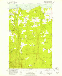
1956 · Morse Creek
USGS Topo · 1:24,000

1957 · Victoria
USGS Topo · 1:250,000