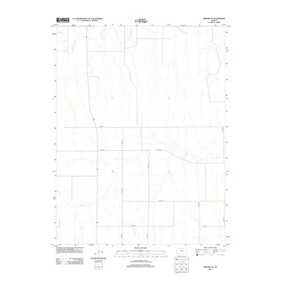
2012 Map of Edmond SE
USGS Topo · Published 2012About this map
The N Fork Solomon River and Bow Cr define the hydrological character of this Norton County landscape. This portion of the High Plains demonstrates a meticulous section-line road grid, where secondary routes like Road E E and Co Rd-362 bisect the open agricultural terrain. Smaller drainage patterns, such as Sand Cr in the northwest, cut through the prairie, illustrating the natural erosion cycles typical of the Kansas watershed. The map records the rural infrastructure as it stood in the early 21st century, showing how modern county roads like Co Rd-555 and Co Rd-561 follow the established survey lines to connect isolated farmsteads and agricultural tracts within the Edmond vicinity.
Find a feature on this map
11 named features on this map. Tap any name to fly to it.
Don’t see what you’re looking for? This feature index may not catch every label — zoom into the map to look around manually.
Map Details
Editions of this 2012 Edmond SE Map
This is the sole edition of this map. No revisions or reprints were ever made.
Other maps of this area

1893 · Norton
USGS Topo · 1:125,000

1893 · Hill
USGS Topo · 1:125,000

1955 · Beloit
USGS Topo · 1:250,000

1959 · Beloit
USGS Topo · 1:250,000

1978 · Edmond
USGS Topo · 1:24,000

1978 · Lenora East
USGS Topo · 1:24,000
1978 · Densmore
USGS Topo · 1:24,000
1978 · Edmond NW
USGS Topo · 1:24,000

1978 · Edmond SE
USGS Topo · 1:24,000
1979 · Logan SW
USGS Topo · 1:24,000