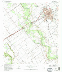
1995 Map of Edna
USGS Topo · Published 1995About this map
Edna serves as the focal point of this coastal prairie landscape, where the town's grid is defined by civic landmarks like the Courthouse, City Hall, and several local schools including Austin Sch and Carver Sch. The Lavaca River meanders through the center of the sheet, its floodplains managed by an extensive system of levees that separate the fertile bottomlands from the surrounding oil fields and agricultural plots. This survey documents a transition from established town life to rural industry, marked by the presence of numerous oil wells and storage facilities near El Toro and Matilda. Historians will find significance in the southern reaches of the river, where the Camp Independence (Site) and a dedicated Historical Monument preserve the memory of Texas's early military history. The landscape is also dotted with family and community landmarks, from the Gideon Cem and Gideon Ch to the west, to the larger Memory Gardens Cemetery north of the city.
Find a feature on this map
34 named features on this map. Tap any name to fly to it.
Don’t see what you’re looking for? This feature index may not catch every label — zoom into the map to look around manually.
Map Details
Editions of this 1995 Edna Map
This is the sole edition of this map. No revisions or reprints were ever made.
Other maps of this area

1951 · Inez
USGS Topo · 1:24,000

1952 · Manson
USGS Topo · 1:24,000

1952 · Edna
USGS Topo · 1:24,000

1952 · La Salle
USGS Topo · 1:24,000

1952 · Marcado Creek
USGS Topo · 1:24,000

1952 · Lolita
USGS Topo · 1:24,000

1953 · Beeville
USGS Topo · 1:250,000

1953 · Seguin
USGS Topo · 1:250,000

1956 · Beeville
USGS Topo · 1:250,000

1958 · Seguin
USGS Topo · 1:250,000