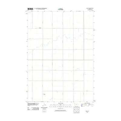
2010 Map of Edna
USGS Topo · Published 2010About this map
The small settlement of Edna anchors the southern portion of this Lyon County landscape, situated near the headwaters of Emery Creek. To the north, Midland occupies a similar position in a territory defined by a rigorous sectional grid of rural roads. The area is characterized by the meandering paths of Tom Creek, which cuts across the central and northern sections, contrasting with the straight lines of thoroughfares like Jackson Ave and Jefferson Ave. This geography reflects the agricultural infrastructure of the region in the early twenty-first century, where transport routes such as 120th St and 180th St facilitate movement between isolated farmsteads and local hubs. The drainages of the creeks serve as the primary natural breaks in an otherwise orderly surveyor’s landscape.
Find a feature on this map
16 named features on this map. Tap any name to fly to it.
Don’t see what you’re looking for? This feature index may not catch every label — zoom into the map to look around manually.
Map Details
Editions of this 2010 Edna Map
This is the sole edition of this map. No revisions or reprints were ever made.
Other maps of this area

1954 · Fairmont
USGS Topo · 1:250,000

1955 · Sioux Falls
USGS Topo · 1:250,000

1958 · Sioux Falls
USGS Topo · 1:250,000

1958 · Fairmont
USGS Topo · 1:250,000

1967 · Adrian SW
USGS Topo · 1:24,000

1967 · Ellsworth
USGS Topo · 1:24,000

1967 · Ash Creek
USGS Topo · 1:24,000

1971 · Edna
USGS Topo · 1:24,000

1971 · George West
USGS Topo · 1:24,000

1971 · Rock Rapids
USGS Topo · 1:24,000