
1969 Map of Edwards
USGS Topo · Published 1971About this map
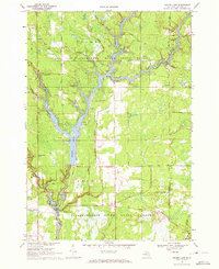
Houghton Lake State Forest and the Tittabawassee River State Forest dominate this Central Michigan landscape, where dense woodlands meet a network of glacial lakes and small-scale industry. In the late 1960s, the rural community of Edwards served as a local hub, anchored by the Edwards Ch and the nearby Edwards Cem. The terrain is defined by its water and drainage patterns, from the northern Gear Lake and Tee Lake down to the Tittabawassee River and its Middle Branch in the south. An active natural resource economy is evident through the numerous Gravel Pits and clustered Oil Wells scattered across the township lines. This area, spanning the borders of Ogemaw, Gladwin, and Roscommon counties, shows a mix of recreational forest land and remote agricultural life, with family-named routes like Kartes Road and Diebold Road providing access to the interior.
Find a feature on this map
51 named features on this map. Tap any name to fly to it.
Don’t see what you’re looking for? This feature index may not catch every label — zoom into the map to look around manually.
Map Details
Editions of this 1969 Edwards Map
This is the sole edition of this map. No revisions or reprints were ever made.
Other maps of this area

1954 · Traverse City
USGS Topo · 1:250,000

1958 · Traverse City
USGS Topo · 1:250,000

1965 · West Branch
USGS Topo · 1:24,000

1965 · St. Helen
USGS Topo · 1:24,000

1965 · Ogemaw Springs
USGS Topo · 1:24,000

1968 · Sterling SW
USGS Topo · 1:24,000

1968 · Sterling NW
USGS Topo · 1:24,000

1969 · Butman
USGS Topo · 1:24,000

1969 · Wagarville
USGS Topo · 1:24,000
1969 · Secord Lake
USGS Topo · 1:24,000