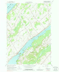
1963 Map of Edwardsville
USGS Topo · Published 1988About this map
Black Lake dominates the central landscape of this St. Lawrence County survey, serving as a focal point for several small lakeside settlements and recreational areas. Along its northern shores, Edwardsville sits near a narrow crossing point, while further inland, the agricultural character of the region is defined by a dense network of roads such as English Settlement Road and Scotch Bush Road. These routes connect dispersed community landmarks like the Scotch Bush Grange and the Stone Ch Cem.
Find a feature on this map
45 named features on this map. Tap any name to fly to it.
Don’t see what you’re looking for? This feature index may not catch every label — zoom into the map to look around manually.
Map Details
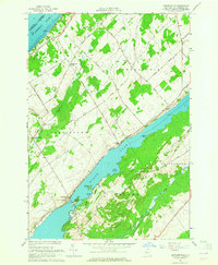
Editions of this 1963 Edwardsville Map
2 editions found
Other maps of this area

1904 · Ogdensburg
USGS Topo · 1:62,500

1905 · Ogdensburg
USGS Topo · 1:62,500

1906 · Brier Hill
USGS Topo · 1:62,500

1912 · Hammond
USGS Topo · 1:62,500

1915 · Gouverneur
USGS Topo · 1:62,500

1937 · Gouverneur
USGS Topo · 1:62,500

1942 · Morristown
USGS Topo · 1:24,000

1943 · Ogdensburg East
USGS Topo · 1:31,680

1943 · Morristown
USGS Topo · 1:31,680

1943 · Edwardsville
USGS Topo · 1:31,680