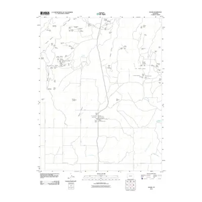
2010 Map of Egnar
USGS Topo · Published 2010About this map
Egnar serves as the primary settlement hub for this Colorado mining district, surrounded by an extensive network of uranium and vanadium claims. The landscape is defined by the deep incisions of Summit Canyon, Bishop Canyon, and Bell Creek, which drop away from the high plateaus where many of the mines are situated. The density of mining activity is particularly high along the canyon rims, with family-named or colorful claims like the Michael Bray Mine, Goforth Homestead Mine, and the Queen of Spades Mine illustrating the area's geological bounty.
Find a feature on this map
104 named features on this map. Tap any name to fly to it.
Don’t see what you’re looking for? This feature index may not catch every label — zoom into the map to look around manually.
Map Details
Editions of this 2010 Egnar Map
This is the sole edition of this map. No revisions or reprints were ever made.
Other maps of this area

1885 · La Sal
USGS Topo · 1:250,000

1886 · Abajo
USGS Topo · 1:250,000

1892 · Abajo
USGS Topo · 1:250,000

1893 · Abajo
USGS Topo · 1:250,000

1916 · Paradox Valley
USGS Topo · 1:125,000

1922 · Paradox Valley
USGS Topo · 1:125,000

1948 · Horse Range Mesa
USGS Topo · 1:24,000

1948 · Hamm Canyon
USGS Topo · 1:24,000

1949 · Egnar
USGS Topo · 1:24,000

1949 · Joe Davis Hill
USGS Topo · 1:24,000