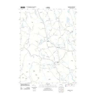
2012 Map of Egremont
USGS Topo · Published 2012About this map
The Green River and its numerous tributaries, including Alford Brook and Seekonk Brook, define the drainage patterns of this Berkshire County landscape. In the early 21st century, the area maintains a distinct village structure centered on North Egremont and South Egremont, connected by a network of historic roads like Stagecoach Rd and Shun Toll Rd. The map illustrates a region where local aviation at Walter J Koladza Airport and education at Simons Rock Early College coexist with the prominent peaks of the Taconic Range, such as Mount Bushnell and Mount Fray. Notable local history is preserved at the Riverside Cem, while the southern reaches of the map show the transition into the Jug End area, characterized by a concentration of ponds like Harman Marsh Pond and Davis Pond.
Find a feature on this map
125 named features on this map. Tap any name to fly to it.
Don’t see what you’re looking for? This feature index may not catch every label — zoom into the map to look around manually.
Map Details
Editions of this 2012 Egremont Map
This is the sole edition of this map. No revisions or reprints were ever made.
Other maps of this area

1885 · Sheffield
USGS Topo · 1:62,500

1888 · Sheffield
USGS Topo · 1:62,500

1888 · Pittsfield
USGS Topo · 1:62,500

1890 · Pittsfield
USGS Topo · 1:62,500

1891 · Sheffield
USGS Topo · 1:62,500

1893 · Sheffield
USGS Topo · 1:62,500

1893 · Pittsfield
USGS Topo · 1:62,500

1894 · Pittsfield
USGS Topo · 1:62,500

1897 · Pittsfield
USGS Topo · 1:62,500

1897 · Sheffield
USGS Topo · 1:62,500