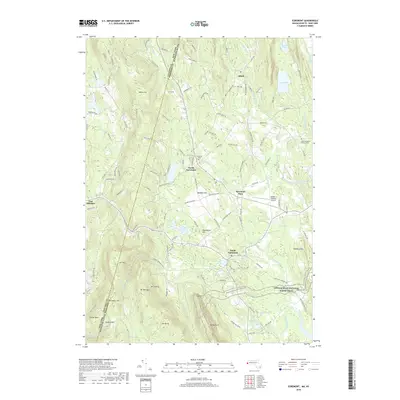
2018 Map of Egremont
USGS Topo · Published 2018About this map
The Green River winds through this Berkshire County landscape, defining the agricultural and residential character of the settlements at North Egremont and Egremont Plain. The terrain rises sharply toward the southwest, where peaks like Mt Fray and Mt Sterling overlook the valley. This late-2010s survey captures a community deeply shaped by its natural water features, from the broad expanse of Marsh Pond and Mill Pond to the high-elevation Harman Marsh Pond near Mt Bushnell.
Find a feature on this map
124 named features on this map. Tap any name to fly to it.
Don’t see what you’re looking for? This feature index may not catch every label — zoom into the map to look around manually.
Map Details
Editions of this 2018 Egremont Map
This is the sole edition of this map. No revisions or reprints were ever made.
Other maps of this area

1885 · Sheffield
USGS Topo · 1:62,500

1888 · Sheffield
USGS Topo · 1:62,500

1888 · Pittsfield
USGS Topo · 1:62,500

1890 · Pittsfield
USGS Topo · 1:62,500

1891 · Sheffield
USGS Topo · 1:62,500

1893 · Sheffield
USGS Topo · 1:62,500

1893 · Pittsfield
USGS Topo · 1:62,500

1894 · Pittsfield
USGS Topo · 1:62,500

1897 · Pittsfield
USGS Topo · 1:62,500

1897 · Sheffield
USGS Topo · 1:62,500