2021 Map of Egremont
USGS Topo · Published 2021About this map
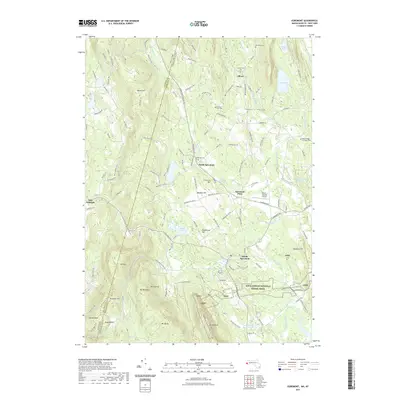
The Taconic Range dominates the western skyline of this Berkshire County landscape, where the Appalachian National Scenic Trail winds through the high terrain near Mt Bushnell and Jug End. In the valleys below, the Green River and Alford Brook define the settlement patterns of Alford and North Egremont. This 2021 survey illustrates the modern intersection of education and local infrastructure, featuring the campus of Bard College at Simon's Rock and the Walter J Koladza Airport. Genealogists will find several preserved burial grounds, including Riverside Cem and Center Cem, providing clear points of reference for local families. The map also captures the state boundary between New York and Massachusetts, showing how local roads like Hillsdale Rd cross the divide between Berkshire and Columbia counties.
Find a feature on this map
136 named features on this map. Tap any name to fly to it.
Don’t see what you’re looking for? This feature index may not catch every label — zoom into the map to look around manually.
Map Details
Editions of this 2021 Egremont Map
This is the sole edition of this map. No revisions or reprints were ever made.
Other maps of this area

1885 · Sheffield
USGS Topo · 1:62,500

1888 · Sheffield
USGS Topo · 1:62,500

1888 · Pittsfield
USGS Topo · 1:62,500

1890 · Pittsfield
USGS Topo · 1:62,500

1891 · Sheffield
USGS Topo · 1:62,500

1893 · Sheffield
USGS Topo · 1:62,500

1893 · Pittsfield
USGS Topo · 1:62,500

1894 · Pittsfield
USGS Topo · 1:62,500

1897 · Pittsfield
USGS Topo · 1:62,500

1897 · Sheffield
USGS Topo · 1:62,500