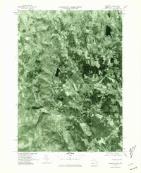
1975 Map of Egremont
USGS Topo · Published 1981About this map
South Egremont and North Egremont anchor this Berkshire County orthophotograph, which provides a detailed overhead view of the southwestern Massachusetts landscape during the mid-1970s. The imagery reveals the distinct agricultural patterns and woodlots of the region, specifically around Egremont Plain. Unlike traditional line maps, this photographic study clearly shows the distribution of farmsteads and the dense forest cover surrounding Prospect Lake. The drainage of the land is defined by the Green River and the Williams River, which cut through the undulating valley floor. This 1975 aerial record, published by the Commonwealth of Massachusetts Department of Public Works and the USGS, preserves the physical layout of the borderlands near Alford before later development altered the rural character of these colonial-era settlements.
Find a feature on this map
7 named features on this map. Tap any name to fly to it.
Don’t see what you’re looking for? This feature index may not catch every label — zoom into the map to look around manually.
Map Details
Editions of this 1975 Egremont Map
This is the sole edition of this map. No revisions or reprints were ever made.
Other maps of this area

1885 · Sheffield
USGS Topo · 1:62,500

1888 · Sheffield
USGS Topo · 1:62,500

1888 · Pittsfield
USGS Topo · 1:62,500

1890 · Pittsfield
USGS Topo · 1:62,500

1891 · Sheffield
USGS Topo · 1:62,500

1893 · Sheffield
USGS Topo · 1:62,500

1893 · Pittsfield
USGS Topo · 1:62,500

1894 · Pittsfield
USGS Topo · 1:62,500

1897 · Pittsfield
USGS Topo · 1:62,500

1897 · Sheffield
USGS Topo · 1:62,500