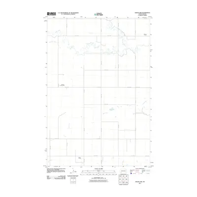
2011 Map of Ehler Lake
USGS Topo · Published 2011About this map
Cedar Creek meanders across the northern reaches of this Adams County landscape, defining a terrain shaped by the slow drainages of the Missouri Plateau. This 2011 survey documents a quiet rural expanse where water is the primary landmark, from the central basin of Ehler Lake to the branching paths of Goose Creek and Chanta Peta Creek. The map provides specific points of interest for genealogists and local historians, most notably the Richland Cemetery located in the northeast corner near the Richland County line. Settlement patterns here are tied to the grid of local roads, such as 14th Ave NW and 5th St NW, which connect isolated homesteads and private aviation sites. The inclusion of the Kinsvater Landing Strip and Olson Airfield highlights the reliance on small-scale air travel in these sprawling prairie reaches, where traditional townsites are absent and the economy remains firmly rooted in the surrounding land.
Find a feature on this map
24 named features on this map. Tap any name to fly to it.
Don’t see what you’re looking for? This feature index may not catch every label — zoom into the map to look around manually.
Map Details
Editions of this 2011 Ehler Lake Map
This is the sole edition of this map. No revisions or reprints were ever made.
Other maps of this area

1953 · Dickinson
USGS Topo · 1:250,000

1957 · Dickinson
USGS Topo · 1:250,000

1973 · Liens Dams
USGS Topo · 1:24,000

1973 · Enterprise School
USGS Topo · 1:24,000

1973 · Abbey Hill
USGS Topo · 1:24,000

1974 · Hettinger North
USGS Topo · 1:24,000

1980 · Mott
USGS Topo · 1:100,000
2011 · Taylor Butte SE
USGS Topo · 1:24,000
2011 · Enterprise School
USGS Topo · 1:24,000
2011 · Wolf Butte
USGS Topo · 1:24,000