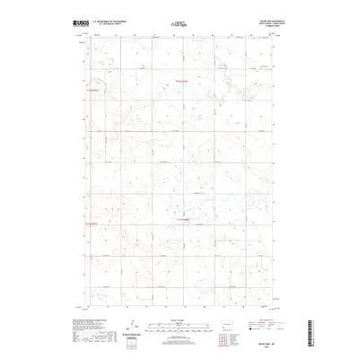
2020 Map of Ehler Lake
USGS Topo · Published 2020About this map
The rolling grasslands of Adams County are defined by a network of drainage creeks and seasonal wetlands in this 2020 topographical study. Ehler Lake serves as a central hydrological feature, surrounded by the headwaters of multiple regional streams. The landscape is structured by a rigorous sectional grid of rural roads, including 18th Ave NW and 10th Ave NW, reflecting the enduring legacy of the Public Land Survey System in North Dakota's agricultural heartland.
Find a feature on this map
22 named features on this map. Tap any name to fly to it.
Don’t see what you’re looking for? This feature index may not catch every label — zoom into the map to look around manually.
Map Details
Editions of this 2020 Ehler Lake Map
This is the sole edition of this map. No revisions or reprints were ever made.
Other maps of this area

1953 · Dickinson
USGS Topo · 1:250,000

1957 · Dickinson
USGS Topo · 1:250,000

1973 · Liens Dams
USGS Topo · 1:24,000

1973 · Enterprise School
USGS Topo · 1:24,000

1973 · Abbey Hill
USGS Topo · 1:24,000

1974 · Hettinger North
USGS Topo · 1:24,000

1980 · Mott
USGS Topo · 1:100,000
2011 · Taylor Butte SE
USGS Topo · 1:24,000
2011 · Enterprise School
USGS Topo · 1:24,000
2011 · Wolf Butte
USGS Topo · 1:24,000