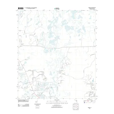
2012 Map of Ehren
USGS Topo · Published 2012About this map
Ehren and the surrounding Pasco County landscape are defined by an intricate network of wetlands and namesake basins. In this 2012 survey, the terrain is dominated by water features like The Rafters, Parker Lake, and the winding Cypress Cr. The transition from rural acreage to suburban development is evident in the burgeoning residential street grids appearing near Wesley Chapel and around named bodies of water such as Red Bug Lake and Wistaria Lake. Transportation and transit hubs are localized, notably around the Pilot Country Airport in the western reaches. This map illustrates the unique hydrography of the region, where large lakes like Big Fish Lake and clusters like Bird Island Lakes sit alongside newer infrastructure developments like Connerton Blvd and Pleasant Plains Pkwy, showcasing the evolving residential footprint of central Florida.
Find a feature on this map
85 named features on this map. Tap any name to fly to it.
Don’t see what you’re looking for? This feature index may not catch every label — zoom into the map to look around manually.
Map Details
Editions of this 2012 Ehren Map
This is the sole edition of this map. No revisions or reprints were ever made.
Other maps of this area

1943 · Odessa
USGS Topo · 1:24,000

1943 · Lutz
USGS Topo · 1:24,000

1944 · Wesley Chapel
USGS Topo · 1:31,680

1944 · Lutz
USGS Topo · 1:31,680

1944 · Odessa
USGS Topo · 1:31,680

1949 · Odessa
USGS Topo · 1:25,000

1954 · Spring Lake
USGS Topo · 1:24,000

1954 · Ehren
USGS Topo · 1:24,000

1954 · San Antonio
USGS Topo · 1:24,000

1954 · Fivay
USGS Topo · 1:24,000