
1943 Map of Lutz
USGS Topo · Published 1961About this map
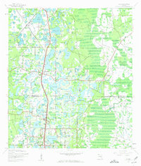
The boundary between Pasco Co and Hillsborough Co defines this landscape of countless freshwater basins and cypress wetlands during the early 1940s. The settlement of Lutz serves as a central hub, flanked by a network of lakes including Lake Thomas, Lake Padgett, and Lake Kell. Transportation is dominated by the parallel routes of the Atlantic Coast Line and Seaboard Air Line railroads, which facilitated the movement of goods and people through the interior. Early mid-century tourism and local recreation are evident at Dupree Gardens and Deer Park, while community centers like Drexel Ch and the Drexel (Sta) mark established neighborhoods. The map reveals an intricate mosaic of named water bodies like Banjo Lake, Catfish Lake, and Gooseneck Lake, interspersed with rural hamlets such as Denham and Worthington Gardens.
Find a feature on this map
54 named features on this map. Tap any name to fly to it.
Don’t see what you’re looking for? This feature index may not catch every label — zoom into the map to look around manually.
Map Details
Editions of this 1943 Lutz Map
2 editions found
Other maps of this area

1943 · Odessa
USGS Topo · 1:24,000

1943 · Thonotosassa
USGS Topo · 1:24,000

1944 · Sulphur Springs
USGS Topo · 1:31,680

1944 · Wesley Chapel
USGS Topo · 1:31,680

1944 · Lutz
USGS Topo · 1:31,680

1944 · Odessa
USGS Topo · 1:31,680

1944 · Thonotosassa
USGS Topo · 1:31,680

1945 · Sulphur Springs
USGS Topo · 1:31,680
1947 · Citrus Park
USGS Topo · 1:24,000
1949 · Sulphur Springs
USGS Topo · 1:25,000